Houski AVM (automated valuation model) report
Sep 27th, 2026 (2026-09-27)
Property information (estimated)
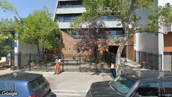
| Address | 302 610 17 Avenue SW |
| Location | Calgary, Alberta, Canada |
| Coordinates | 51.038193, -114.075104 |
| Interior Size | 995 ft² (92 m²) |
| Property Type | Apartment |
| Bedrooms | 2 |
| Den | 0 |
| Full Bathrooms | 1 |
| Half Bathrooms | 1 |
| Year Built | 1979 |
Valuation estimates
Model performance metrics
Sale price model
List price model
Rental price model
Property scores and risk indicators
Net rating: above average (7/10 (73%) overall).
Natural hazards
| Category | Score | Rating |
|---|---|---|
| Flood | 9/10 | Strong |
| Fire | 10/10 | Strong |
| Earthquake | 9/10 | Strong |
| Hurricane | 10/10 | Strong |
| Tornado | 8/10 | Strong |
| Air quality | 6/10 | Average |
| Water quality | 8/10 | Strong |
Location quality
| Category | Score | Rating |
|---|---|---|
| Walkability | 10/10 | Strong |
| Transit | 10/10 | Strong |
| Bicycle | 9/10 | Strong |
| Safety | 6/10 | Average |
| Curb appeal | 5/10 | Average |
| Cell coverage | 10/10 | Strong |
| Internet | 10/10 | Strong |
| Quiet | 3/10 | Concerning |
| Smell | 6/10 | Average |
| Traffic | 0/10 | Concerning |
| Parking | 10/10 | Strong |
| Nature | 6/10 | Average |
| Education | 9/10 | Strong |
| Family | 0/10 | Concerning |
| Retirement | 0/10 | Concerning |
| Entertainment | 10/10 | Strong |
| Food and drink | 10/10 | Strong |
| Shopping | 9/10 | Strong |
Comparable properties
These are nearby properties of the same type and similar size. The list price shown for each one is the last asking price we observed before it left the market, not its original listing price, which keeps it close to the estimated sale date and avoids distortion from homes that were listed too high at first and later reduced.
We rank each comparable by a match score that combines how far its price and size are from this home, with a lighter weight on distance. A lower score means a closer match, and the table shows the 10 lowest.
\[ \text{score} = \left(\frac{P - P_0}{P_0}\right)^2 + \left(\frac{A - A_0}{A_0}\right)^2 + 0.5\left(\frac{d}{5}\right)^2 \]
where \(P\) is the comparable's last known list price, \(P_0\) is this home's estimated list price, \(A\) and \(A_0\) are their interior areas, and \(d\) is the distance in kilometres.
| Photo | Address | Distance | Interior | $ / ft² | List Price | Sale Date (Estimated) |
|---|---|---|---|---|---|---|
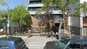 | 402 610 17 Avenue SW | 0.00 km | 989 ft² | $298 | $295,000 | 2025-02-07 |
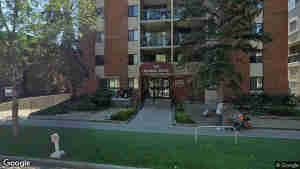 | 101 523 15 Avenue SW | 0.16 km | 990 ft² | $291 | $288,888 | 2023-08-29 |
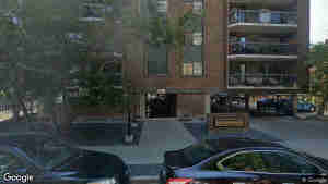 | 703 537 14 Avenue SW | 0.18 km | 963 ft² | $311 | $300,000 | 2023-07-23 |
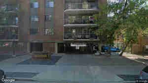 | 406 537 14 Avenue SW | 0.18 km | 961 ft² | $311 | $298,900 | 2023-07-23 |
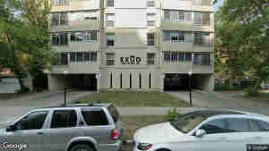 | 1105 1209 6 Street SW | 0.40 km | 1001 ft² | $299 | $299,900 | 2023-08-23 |
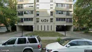 | 1005 1209 6 Street SW | 0.40 km | 1009 ft² | $297 | $299,900 | 2023-09-09 |
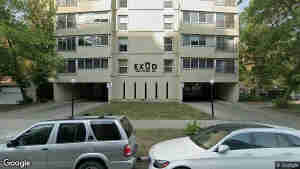 | 401 1209 6 Street SW | 0.40 km | 1000 ft² | $294 | $294,000 | 2024-01-18 |
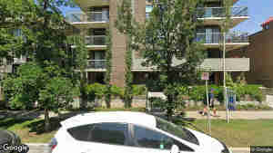 | 504 616 15 Avenue SW | 0.11 km | 945 ft² | $306 | $289,900 | 2025-07-04 |
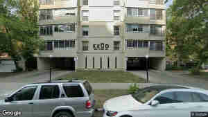 | 305 1209 6 Street SW | 0.40 km | 1015 ft² | $285 | $290,000 | 2024-08-04 |
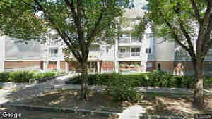 | 210 540 18 Avenue SW | 0.15 km | 920 ft² | $325 | $299,000 | 2025-09-15 |
Disclaimer
Valuations come from machine learning models using comparable listings, market trends, and location. Use as a reference only - not a formal appraisal.
For investment or purchase decisions, get a professional appraisal from a licensed appraiser.
Automated valuation model report
Sep 27th, 2026 (2026-09-27)
Property information (estimated)
| Address | 302 610 17 Avenue SW |
| Location | Calgary, Alberta, Canada |
| Coordinates | 51.038193, -114.075104 |
| Interior Size | 995 ft² (92 m²) |
| Property Type | Apartment |
| Bedrooms | 2 |
| Den | 0 |
| Full Bathrooms | 1 |
| Half Bathrooms | 1 |
| Year Built | 1979 |
Valuation estimates
Estimated list price
$298,345
Estimated sale price
$293,550
Estimated monthly rent
$2,266
Price trend
Our estimated list and sale price for this property over the past 18 months. Each point is a model estimate of value for that month, based on the property as it is today, not a recorded sale.
| Date | List price | Sale price |
|---|---|---|
| 2025-04-05 | 336395 | 302583 |
| 2025-05-05 | 335353 | 304994 |
| 2025-06-04 | 337475 | 303306 |
| 2025-07-04 | 336525 | 301711 |
| 2025-08-03 | 333141 | 300834 |
| 2025-09-02 | 332321 | 292419 |
| 2025-10-02 | 320705 | 291787 |
| 2025-11-01 | 320006 | 292606 |
| 2025-12-01 | 314523 | 289831 |
| 2025-12-31 | 310465 | 286918 |
| 2026-01-30 | 311569 | 286599 |
| 2026-03-01 | 302997 | 286599 |
| 2026-03-31 | 303709 | 286457 |
| 2026-04-30 | 302265 | 287158 |
| 2026-05-30 | 299114 | 287043 |
| 2026-06-29 | 297828 | 293549 |
| 2026-07-29 | 297253 | 293549 |
| 2026-08-28 | 300337 | 293549 |
| 2026-09-27 | 298344 | 293549 |
| Date | Monthly rent |
|---|---|
| 2025-04-05 | 2298 |
| 2025-05-05 | 2292 |
| 2025-06-04 | 2290 |
| 2025-07-04 | 2290 |
| 2025-08-03 | 2226 |
| 2025-09-02 | 2226 |
| 2025-10-02 | 2223 |
| 2025-11-01 | 2227 |
| 2025-12-01 | 2173 |
| 2025-12-31 | 2173 |
| 2026-01-30 | 2160 |
| 2026-03-01 | 2141 |
| 2026-03-31 | 2142 |
| 2026-04-30 | 2126 |
| 2026-05-30 | 2130 |
| 2026-06-29 | 2131 |
| 2026-07-29 | 2266 |
| 2026-08-28 | 2266 |
| 2026-09-27 | 2266 |
Flags
Things we detected that are worth looking into before you rely on this estimate.
Model configuration & statisticsHow these models are built and validated
Sale price model
List price model
Rental price model
Property scores and risk indicators
Natural hazards
▸Flood9/10Strong
A rating from 0 to 10 of how often the area around a property floods, where higher numbers mean the surrounding area floods less often. It reflects the area, not the individual home.
A low score does not always mean this home will flood. It might sit on higher ground and stay dry, but a nearby flood plain can still affect it a great deal, because flooding damages surrounding roads, utilities, and services and drags on value and insurance across the whole area. Use a low score as a prompt to look into whether this particular home is genuinely at risk.
- 0-2: Very high flood exposure - The surrounding area floods readily
- 3-4: High flood exposure - The area sees significant flooding
- 5-6: Moderate flood safety - Some flood-prone conditions nearby
- 7-8: High flood safety - The area floods only rarely
- 9-10: Very high flood safety - The surrounding area is very unlikely to flood
▸Fire10/10Strong
A score measuring fire safety in the area, ranging from 0 to 10, with higher numbers indicating lower fire hazard.
This score helps residents and property seekers understand the fire-related risks associated with a specific location, considering factors that could impact property safety, insurance, and emergency preparedness.
- 0-2: Very High Hazard - Extreme fire vulnerability
- 3-4: High Hazard - Significant fire risk
- 5-6: Moderate Safety - Some fire danger factors
- 7-8: High Safety - Rare fire occurrence potential
- 9-10: Very High Safety - Minimal fire concerns
▸Earthquake9/10Strong
A score measuring earthquake safety in the area, ranging from 0 to 10, with higher numbers indicating lower seismic hazard.
This score helps residents and property seekers understand the geological risks associated with a specific location, considering factors that could impact property safety and insurance.
- 0-2: Very High Hazard - Extreme earthquake vulnerability
- 3-4: High Hazard - Significant seismic risk
- 5-6: Moderate Safety - Some earthquake potential
- 7-8: High Safety - Rare seismic activity
- 9-10: Very High Safety - Minimal earthquake concerns
▸Hurricane10/10Strong
A score measuring hurricane safety in the area, ranging from 0 to 10, with higher numbers indicating lower hurricane hazard.
This score helps residents and property seekers understand the hurricane-related risks associated with a specific location, considering factors that could impact property safety, insurance, and emergency preparedness.
- 0-2: Very High Hazard - Extreme hurricane vulnerability
- 3-4: High Hazard - Significant hurricane risk
- 5-6: Moderate Safety - Some hurricane potential
- 7-8: High Safety - Rare hurricane occurrence
- 9-10: Very High Safety - Minimal hurricane concerns
▸Tornado8/10Strong
A score measuring tornado safety in the area, ranging from 0 to 10, with higher numbers indicating lower tornado hazard.
This score helps residents and property seekers understand the tornado-related risks associated with a specific location, considering factors that could impact property safety, insurance, and emergency preparedness.
- 0-2: Very High Hazard - Extreme tornado vulnerability
- 3-4: High Hazard - Significant tornado risk
- 5-6: Moderate Safety - Some tornado potential
- 7-8: High Safety - Rare tornado occurrence
- 9-10: Very High Safety - Minimal tornado concerns
▸Air quality6/10Average
A comprehensive score measuring the air quality in the area, ranging from 0 to 10, with higher numbers indicating cleaner, healthier air.
This score helps residents and property seekers understand the environmental health of a specific location, considering factors that impact breathing and overall well-being.
- 0-2: Very Poor - Significant air pollution concerns
- 3-4: Poor - Noticeable air quality issues
- 5-6: Moderate - Some air quality limitations
- 7-8: Good - Clean and healthy air conditions
- 9-10: Excellent - Pristine air quality with minimal pollutants
▸Water quality8/10Strong
A score for the overall quality of local surface water (rivers, lakes, streams), ranging from 0 to 10, with higher numbers indicating cleaner waterways.
This score measures the freshwater you actually swim in, fish in, or live next to, not literally tap water. Buyers care about it for recreational water use, property value next to clean water, contamination risk to private wells, and the overall environmental health of the area.
- 0-2: Very Poor - Significant local surface water issues
- 3-4: Poor - Notable water quality pressures
- 5-6: Marginal - Mixed conditions
- 7-8: Fair to Good - Clean local surface water
- 9-10: Excellent - Pristine local surface water
Location quality
▸Walkability10/10Strong
A comprehensive score measuring how easy and pleasant it is to walk around the area, ranging from 0 to 10, with higher numbers indicating more pedestrian-friendly environments.
This score helps residents and visitors understand the walkability of a location, considering factors like sidewalk quality, proximity to destinations, safety, and overall ease of walking.
- 0-2: Very Poor - Almost impossible to walk
- 3-4: Poor - Significant walking challenges
- 5-6: Moderate - Some walkable areas
- 7-8: Good - Very pedestrian-friendly
- 9-10: Excellent - Perfect for walking everywhere
▸Transit10/10Strong
A comprehensive score measuring the quality and accessibility of public transportation in the area, ranging from 0 to 10, with higher numbers indicating more extensive and convenient transit options.
This score helps residents and commuters understand the public transportation landscape of a location, considering factors like transit variety, service frequency, and overall ease of getting around without a personal vehicle.
- 0-2: Very Poor - Almost no public transit
- 3-4: Poor - Limited transportation options
- 5-6: Moderate - Some transit availability
- 7-8: Good - Reliable public transportation
- 9-10: Excellent - Exceptional transit network
▸Bicycle9/10Strong
A comprehensive score measuring how bicycle-friendly an area is, ranging from 0 to 10, with higher numbers indicating better conditions for cycling.
This score helps residents and property seekers understand the cycling potential of a location, considering factors like bike lanes, safety, and overall cycling infrastructure.
- 0-2: Very Poor - Extremely challenging for cyclists
- 3-4: Poor - Limited bicycle infrastructure
- 5-6: Moderate - Some cycling opportunities
- 7-8: Good - Strong support for cyclists
- 9-10: Excellent - Ideal for cycling enthusiasts
▸Safety6/10Average
A comprehensive score measuring the safety of the area, ranging from 0 to 10, with higher numbers indicating a safer, more secure neighborhood.
This score helps residents and property seekers understand the overall safety profile of a specific location, considering various factors that contribute to community security.
- 0-2: Very High Risk - Significant safety concerns
- 3-4: High Risk - Frequent safety incidents
- 5-6: Moderate Risk - Some safety challenges
- 7-8: Low Risk - Generally safe environment
- 9-10: Very Low Risk - Exceptionally safe neighborhood
▸Curb appeal5/10Average
A score from 0 to 10 reflecting how the area around this home looks from the street. Higher numbers indicate prettier, better-tended surroundings.
The score captures the AREA, not the specific home. It blends education and income of nearby residents, walkability, quietness, freedom from industrial smells, neighbourhood safety, and how much homes in the area typically list for. Two homes on the same street will usually score very similarly.
- 0-2: Surrounding area presents poorly. Often near industry or in significant decline.
- 3-4: Mixed surroundings. Less investment in upkeep, higher noise, or lower income.
- 5-6: Average area. Typical suburban or mid-tier urban surroundings.
- 7-8: Pleasant area. Quiet, walkable, well-tended streetscape.
- 9-10: Premium area. Tree-lined heritage or established affluent surroundings.
▸Cell coverage10/10Strong
A comprehensive score measuring mobile network coverage in the area, ranging from 0 to 10, with higher numbers indicating better cellular connectivity.
This score reflects the density and modernity of the cellular infrastructure serving the area, along with known coverage gaps. It is not a direct signal-strength measurement.
- 0-2: Very Poor - Minimal to no usable cell service
- 3-4: Poor - Unreliable mobile connectivity
- 5-6: Moderate - Inconsistent network performance
- 7-8: Good - Reliable cell phone coverage
- 9-10: Excellent - Top-tier mobile network quality
▸Internet10/10Strong
A score from 0 to 10 reflecting how many strong internet options are available at this home and how fast they are. Higher numbers mean faster connections AND more choices.
Each available option adds to the score: a gigabit fibre line to the home, fast wired broadband, fast cellular home internet, and modern satellite service. A home with several options scores higher than a home with only one, because backup choices matter when the primary connection has an outage.
- 10: Every major option is available at the home. Fibre, fast wired broadband, fast cellular home internet, and modern satellite all reach this address.
- 8-9: Fibre reaches the home and at least one other strong option is available, OR no fibre but most of the other top options are present.
- 5-7: One strong wired or wireless option plus one backup, such as cable broadband paired with satellite.
- 3-4: A single decent option, or a couple of slower ones that handle email and browsing but struggle with streaming.
- 1-2: Very low speed service or older high-latency satellite, suitable only for the lightest use.
- 0: No broadband service of any kind available at the home.
▸Quiet3/10Concerning
A comprehensive score measuring the noise levels and acoustic quality of an area, ranging from 0 to 10, with higher numbers indicating a more peaceful and quiet environment.
This score helps residents and property seekers understand the sound landscape of a location, considering factors like traffic, industrial noise, proximity to loud areas, and overall acoustic comfort.
- 0-2: Very Loud - Constant noise disruptions
- 3-4: Noisy - Frequent sound disturbances
- 5-6: Moderate - Some background noise
- 7-8: Quiet - Peaceful with minimal interruptions
- 9-10: Very Quiet - Nearly silent, exceptionally peaceful
▸Smell6/10Average
A comprehensive score measuring the olfactory quality of an area, ranging from 0 to 10, with higher numbers indicating a more pleasant-smelling environment.
This score helps residents and property seekers understand the smell landscape of a location, considering factors like industrial emissions, natural odors, and overall air quality.
- 0-2: Very Unpleasant - Constant offensive odors
- 3-4: Poor - Frequent smell disturbances
- 5-6: Moderate - Some noticeable odors
- 7-8: Good - Mostly clean-smelling environment
- 9-10: Excellent - Pristine, fresh-smelling air
▸Traffic0/10Concerning
A comprehensive score measuring the traffic conditions in an area, ranging from 0 to 10, with higher numbers indicating easier and more efficient transportation.
This score reflects how exposed the area is to busy major roads, with lighter, calmer local traffic scoring higher.
- 0-2: Very Poor - Extreme traffic congestion
- 3-4: Poor - Significant transportation challenges
- 5-6: Moderate - Some traffic issues
- 7-8: Good - Relatively smooth traffic flow
- 9-10: Excellent - Minimal congestion and easy commutes
▸Parking10/10Strong
A comprehensive score measuring the parking convenience in an area, ranging from 0 to 10, with higher numbers indicating easier and more accessible parking options.
This score reflects how plentiful parking supply tends to be in the area, with more abundant supply scoring higher.
- 0-2: Very Poor - Extreme parking challenges
- 3-4: Poor - Significant parking difficulties
- 5-6: Moderate - Some parking options available
- 7-8: Good - Convenient parking access
- 9-10: Excellent - Abundant and easy parking
▸Nature6/10Average
A comprehensive score measuring the quality and accessibility of natural environments in the area, ranging from 0 to 10, with higher numbers indicating more extensive and high-quality natural spaces.
This score reflects how much green space, such as parks, forests, and natural areas, is close to the area, with more nearby green space scoring higher.
- 0-2: Very Limited - Almost no natural areas
- 3-4: Poor - Minimal green spaces
- 5-6: Moderate - Some natural environments
- 7-8: Good - Abundant and diverse natural spaces
- 9-10: Excellent - Exceptional green space and natural areas nearby
▸Education9/10Strong
A score measuring how accessible nearby schools are, ranging from 0 to 10, with higher numbers indicating more schools within easy reach.
This score reflects how many schools are nearby and how close they are. It does not measure school ratings, test scores, or teaching quality.
- 0-2: Very Poor - Extremely limited educational options
- 3-4: Poor - Significant educational challenges
- 5-6: Moderate - Some educational resources
- 7-8: Good - Strong academic opportunities
- 9-10: Excellent - Exceptional educational environment
▸Family0/10Concerning
A comprehensive score measuring how suitable an area is for families, ranging from 0 to 10, with higher numbers indicating more family-friendly environments.
This score reflects how common families with children are among the households in the area, with more family-oriented neighbourhoods scoring higher.
- 0-2: Very Poor - Minimal family-friendly amenities
- 3-4: Poor - Limited resources for families
- 5-6: Moderate - Some family-oriented features
- 7-8: Good - Strong family support and activities
- 9-10: Excellent - Ideal environment for family living
▸Retirement0/10Concerning
A comprehensive score measuring how suitable an area is for retirees, ranging from 0 to 10, with higher numbers indicating more retirement-friendly environments.
This score reflects how much the resident population of the area skews toward older, settled residents, with a stronger lean scoring higher.
- 0-2: Very Poor - Minimal retirement support
- 3-4: Poor - Limited resources for seniors
- 5-6: Moderate - Some retirement-friendly features
- 7-8: Good - Strong support for retirees
- 9-10: Excellent - Ideal environment for retirement living
▸Entertainment10/10Strong
A comprehensive score measuring the entertainment and recreational opportunities in the area, ranging from 0 to 10, with higher numbers indicating more diverse and exciting local activities.
This score helps residents and property seekers understand the lifestyle and leisure potential of a specific location, considering factors like restaurants, venues, cultural attractions, and recreational options.
- 0-2: Very Limited - Almost no entertainment options
- 3-4: Poor - Very few recreational activities
- 5-6: Moderate - Some local entertainment choices
- 7-8: Good - Plenty of diverse entertainment
- 9-10: Excellent - Vibrant, exciting local scene
▸Food and drink10/10Strong
A comprehensive score measuring the quality and diversity of local food and drink options, ranging from 0 to 10, with higher numbers indicating a more exciting culinary environment.
This score helps residents and food enthusiasts understand the gastronomic potential of a location, considering factors like restaurant variety, cuisine types, dining experiences, and local food culture.
- 0-2: Very Limited - Almost no dining options
- 3-4: Poor - Very few interesting restaurants
- 5-6: Moderate - Some local dining choices
- 7-8: Good - Plenty of diverse food and drink options
- 9-10: Excellent - Vibrant, world-class culinary scene
▸Shopping9/10Strong
A comprehensive score measuring the quality and accessibility of shopping options in the area, ranging from 0 to 10, with higher numbers indicating more extensive and convenient shopping experiences.
This score helps residents and visitors understand the shopping landscape of a location, considering factors like store variety, proximity to retail centers, and overall shopping convenience.
- 0-2: Very Poor - Almost no shopping options
- 3-4: Poor - Limited retail choices
- 5-6: Moderate - Some shopping variety
- 7-8: Good - Diverse and convenient shopping
- 9-10: Excellent - Exceptional shopping nearby
Comparable properties
These are nearby properties of the same type and similar size. The list price shown for each one is the last asking price we observed before it left the market, not its original listing price, which keeps it close to the estimated sale date and avoids distortion from homes that were listed too high at first and later reduced.
We rank each comparable by a match score that combines how far its price and size are from this home, with a lighter weight on distance. A lower score means a closer match, and the table shows the 10 lowest.
\[ \text{score} = \left(\frac{P - P_0}{P_0}\right)^2 + \left(\frac{A - A_0}{A_0}\right)^2 + 0.5\left(\frac{d}{5}\right)^2 \]
where \(P\) is the comparable's last known list price, \(P_0\) is this home's estimated list price, \(A\) and \(A_0\) are their interior areas, and \(d\) is the distance in kilometres.
| Photo | Address | Distance | Interior | $ / ft² | List Price | Sale Date (Estimated) |
|---|---|---|---|---|---|---|
| 402 610 17 Avenue SW | 0.00 km | 989 ft² | $298 | $295,000 | 2025-02-07 |
| 101 523 15 Avenue SW | 0.16 km | 990 ft² | $291 | $288,888 | 2023-08-29 |
| 703 537 14 Avenue SW | 0.18 km | 963 ft² | $311 | $300,000 | 2023-07-23 |
| 406 537 14 Avenue SW | 0.18 km | 961 ft² | $311 | $298,900 | 2023-07-23 |
| 1105 1209 6 Street SW | 0.40 km | 1001 ft² | $299 | $299,900 | 2023-08-23 |
| 1005 1209 6 Street SW | 0.40 km | 1009 ft² | $297 | $299,900 | 2023-09-09 |
| 401 1209 6 Street SW | 0.40 km | 1000 ft² | $294 | $294,000 | 2024-01-18 |
| 504 616 15 Avenue SW | 0.11 km | 945 ft² | $306 | $289,900 | 2025-07-04 |
| 305 1209 6 Street SW | 0.40 km | 1015 ft² | $285 | $290,000 | 2024-08-04 |
| 210 540 18 Avenue SW | 0.15 km | 920 ft² | $325 | $299,000 | 2025-09-15 |
Glossary of terms
AVM (automated valuation model)
A program that estimates property values using data and statistics.
Confidence score
How reliable the model thinks its estimate is. Higher is better.
$$\text{Confidence Score} = 100 - \text{Median MAPE}$$
100 minus median MAPE. If median MAPE is 8%, confidence is 92%.
Training vs testing data
The model learns from training data and is evaluated on held-out testing data. Testing scores reflect real-world performance.
R-squared (coefficient of determination)
How well the model explains property values. 0 to 1, where closer to 1 is better.
$$R^2 = 1 - \frac{SS_{res}}{SS_{tot}}$$
SSres = sum of squared residuals. SStot = total sum of squares.
Mean absolute error (MAE)
Average prediction error in dollars. Lower is better.
$$MAE = \frac{1}{n} \sum_{i=1}^{n} |y_i - \hat{y}_i|$$
yi = actual, ŷi = predicted, n = count.
Root mean square error (RMSE)
Like MAE but penalizes larger errors more. Lower is better.
$$RMSE = \sqrt{\frac{1}{n} \sum_{i=1}^{n} (y_i - \hat{y}_i)^2}$$
MAPE (mean absolute percentage error)
Average error as a percentage. Lower is better.
$$MAPE = \frac{1}{n} \sum_{i=1}^{n} \left|\frac{y_i - \hat{y}_i}{y_i}\right| \times 100\%$$
Median MAPE
Middle of all percentage errors. Less swayed by outliers than MAPE.
Within X% accuracy
Share of predictions within X% of the actual value. Higher is better.
$$\text{Within X%} = \frac{\text{Count of } |\text{error}| \leq X\% \text{ of actual}}{\text{Total predictions}} \times 100\%$$
Mean bias
Whether the model averages high (positive) or low (negative). Closer to zero is better.
$$\text{Mean Bias} = \frac{1}{n} \sum_{i=1}^{n} (\hat{y}_i - y_i)$$
Median bias
Middle prediction error. Less affected by outliers than mean bias.
Over-prediction rate
Share of predictions higher than the actual value.
$$\text{Over-prediction Rate} = \frac{\text{Count of } \hat{y}_i > y_i}{\text{Total predictions}} \times 100\%$$
A balanced model is near 50%.
Under-prediction rate
Share of predictions lower than the actual value.
$$\text{Under-prediction Rate} = \frac{\text{Count of } \hat{y}_i < y_i}{\text{Total predictions}} \times 100\%$$
Percentile error
Error distribution. '90th percentile' means 90% of predictions were more accurate.
Percentile % error
Same as percentile error but as a percentage of the actual value.
Forecast standard deviation
How much predictions vary from the average prediction. Lower is more consistent.
$$\sigma = \sqrt{\frac{1}{n} \sum_{i=1}^{n} (\hat{y}_i - \bar{y})^2}$$
Coefficient of variation
Prediction consistency relative to average value. Lower is better.
$$CV = \frac{\text{Standard Deviation}}{\text{Mean}} \times 100$$
Comparable properties
Similar nearby properties used to estimate value.
Important information
Valuations come from machine learning models using comparable listings, market trends, and location. Use as a reference only.
Accuracy is measured against a held-out benchmark set. Unique property features and current market conditions not captured in the model may affect true value.
For investment or purchase decisions, get a professional appraisal from a licensed appraiser.
This report is not a formal appraisal and should not be the sole basis for financial decisions.
Houski does not offer AVM insurance, value protection, or any accuracy guarantee, and accepts no liability for any difference between this estimate and an actual listing price, sale price, or appraisal. See our terms of service for full details.